


Barles la laupie tourtoureau

Danielba
User GUIDE
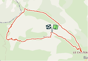

Length
13.5 km

Max alt
2016 m

Uphill gradient
987 m
Km-Effort
27 km

Min alt
1053 m

Downhill gradient
985 m
Boucle
Yes
Creation date :
2023-05-23 06:18:58.284
Updated on :
2023-05-23 15:08:36.305
7h02
Difficulty : Very difficult

FREE GPS app for hiking
 SityTrail
IGN / Geographical institutes
SityTrail Plus
The world is yours!
About
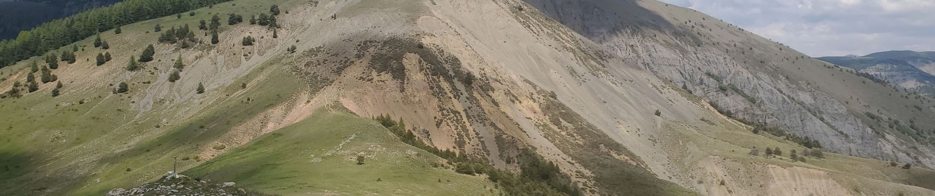
Trail Walking of 13.5 km to be discovered at Provence-Alpes-Côte d'Azur, Alpes-de-Haute-Provence, Barles. This trail is proposed by Danielba .
Photos


Positioning
Country:
France
Region :
Provence-Alpes-Côte d'Azur
Department/Province :
Alpes-de-Haute-Provence
Municipality :
Barles
Location:
Unknown
Start:(Dec)
Start:(UTM)
279951 ; 4906241 (32T) N.
Comments