


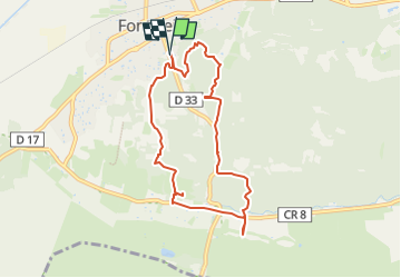
Fontvielle - Aqueduc et Moulins

rando30129
User

Length
8.1 km

Max alt
77 m

Uphill gradient
112 m
Km-Effort
9.6 km

Min alt
16 m

Downhill gradient
111 m
Boucle
Yes
Creation date :
2023-05-23 11:54:21.773
Updated on :
2023-05-23 18:36:40.134
2h10
Difficulty : Medium

FREE GPS app for hiking
 SityTrail
IGN / Geographical institutes
SityTrail Plus
The world is yours!
About
Trail Walking of 8.1 km to be discovered at Provence-Alpes-Côte d'Azur, Bouches-du-Rhône, Fontvieille. This trail is proposed by rando30129.
Photos


Positioning
Country:
France
Region :
Provence-Alpes-Côte d'Azur
Department/Province :
Bouches-du-Rhône
Municipality :
Fontvieille
Location:
Unknown
Start:(Dec)
Start:(UTM)
637735 ; 4842559 (31T) N.
Comments