


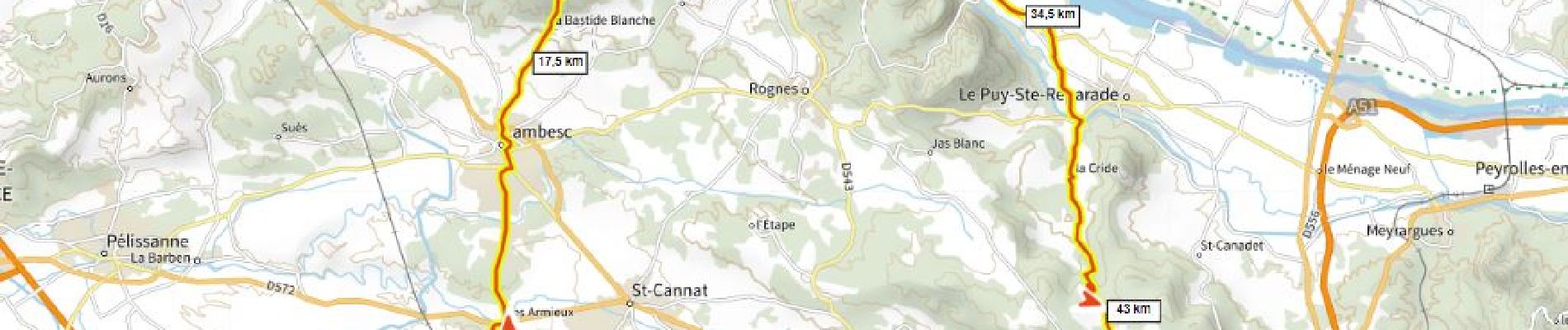
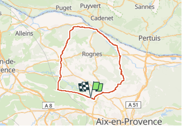
Eguilles La Roque D+840m

ericberlin
User

Length
55 km

Max alt
446 m

Uphill gradient
843 m
Km-Effort
66 km

Min alt
157 m

Downhill gradient
842 m
Boucle
Yes
Creation date :
2023-05-23 15:53:13.677
Updated on :
2023-05-24 15:47:23.076
4h00
Difficulty : Very difficult

FREE GPS app for hiking
 SityTrail
IGN / Geographical institutes
SityTrail Plus
The world is yours!
About
Trail Road bike of 55 km to be discovered at Provence-Alpes-Côte d'Azur, Bouches-du-Rhône, Éguilles. This trail is proposed by ericberlin.
Photos

Positioning
Country:
France
Region :
Provence-Alpes-Côte d'Azur
Department/Province :
Bouches-du-Rhône
Municipality :
Éguilles
Location:
Unknown
Start:(Dec)
Start:(UTM)
689234 ; 4827503 (31T) N.
Comments