


Tour de mercurey VAE

XavierFaidix
User

Length
36 km

Max alt
447 m

Uphill gradient
1027 m
Km-Effort
50 km

Min alt
225 m

Downhill gradient
1020 m
Boucle
Yes
Creation date :
2023-05-24 20:20:16.0
Updated on :
2023-05-24 20:20:12.465
3h26
Difficulty : Medium

FREE GPS app for hiking
 SityTrail
IGN / Geographical institutes
SityTrail Plus
The world is yours!
About
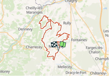
Trail Mountain bike of 36 km to be discovered at Bourgogne-Franche-Comté, Saône-et-Loire, Mercurey. This trail is proposed by XavierFaidix.
Positioning
Country:
France
Region :
Bourgogne-Franche-Comté
Department/Province :
Saône-et-Loire
Municipality :
Mercurey
Location:
Bourgneuf-Val-d'Or
Start:(Dec)
Start:(UTM)
631487 ; 5187941 (31T) N.
Comments