


chastreix

Michelraimbault
User
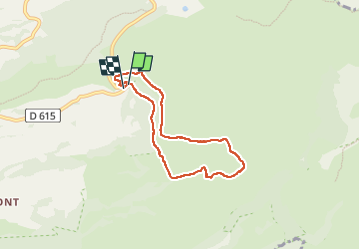

Length
6.1 km

Max alt
1376 m

Uphill gradient
142 m
Km-Effort
8 km

Min alt
1272 m

Downhill gradient
143 m
Boucle
Yes
Creation date :
2023-05-25 12:00:13.156
Updated on :
2023-05-25 14:07:01.731
1h48
Difficulty : Medium

FREE GPS app for hiking
 SityTrail
IGN / Geographical institutes
SityTrail Plus
The world is yours!
About
Trail Walking of 6.1 km to be discovered at Auvergne-Rhône-Alpes, Puy-de-Dôme, Chastreix. This trail is proposed by Michelraimbault.
Positioning
Country:
France
Region :
Auvergne-Rhône-Alpes
Department/Province :
Puy-de-Dôme
Municipality :
Chastreix
Location:
Unknown
Start:(Dec)
Start:(UTM)
482138 ; 5040907 (31T) N.
Comments