


G1 - 2 Col de Menée-Jocou-Grimone

lionelnottat
User

Length
12.2 km

Max alt
2036 m

Uphill gradient
1099 m
Km-Effort
27 km

Min alt
1293 m

Downhill gradient
1207 m
Boucle
No
Creation date :
2023-05-25 18:48:21.716
Updated on :
2023-05-25 18:50:00.556
6h11
Difficulty : Very difficult

FREE GPS app for hiking
 SityTrail
IGN / Geographical institutes
SityTrail Plus
The world is yours!
About
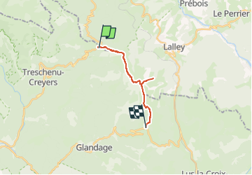
Trail Walking of 12.2 km to be discovered at Auvergne-Rhône-Alpes, Drôme, Châtillon-en-Diois. This trail is proposed by lionelnottat.
Positioning
Country:
France
Region :
Auvergne-Rhône-Alpes
Department/Province :
Drôme
Municipality :
Châtillon-en-Diois
Location:
Treschenu-Creyers
Start:(Dec)
Start:(UTM)
705975 ; 4959251 (31T) N.
Comments