


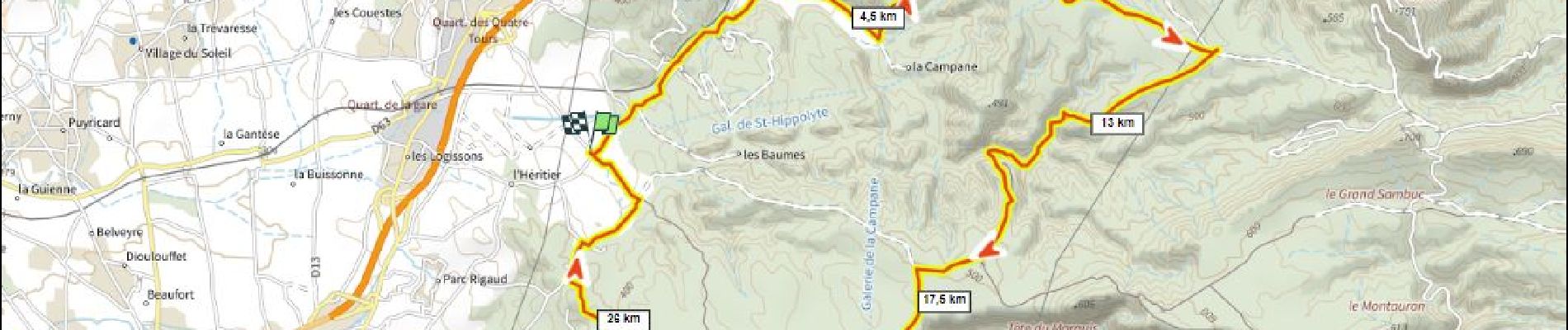
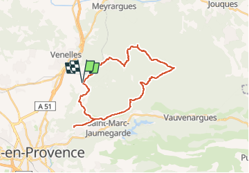
Forêt de Peyrolles D+525m depuis Venelles

ericberlin
User

Length
29 km

Max alt
557 m

Uphill gradient
527 m
Km-Effort
36 km

Min alt
309 m

Downhill gradient
527 m
Boucle
Yes
Creation date :
2023-05-26 14:50:00.332
Updated on :
2023-05-26 16:48:28.727
2h29
Difficulty : Difficult

FREE GPS app for hiking
 SityTrail
IGN / Geographical institutes
SityTrail Plus
The world is yours!
About
Trail Mountain bike of 29 km to be discovered at Provence-Alpes-Côte d'Azur, Bouches-du-Rhône, Venelles. This trail is proposed by ericberlin.
Photos

Positioning
Country:
France
Region :
Provence-Alpes-Côte d'Azur
Department/Province :
Bouches-du-Rhône
Municipality :
Venelles
Location:
Unknown
Start:(Dec)
Start:(UTM)
701615 ; 4828230 (31T) N.
Comments