


T St-Sulpice de Favière

CSR-94
User
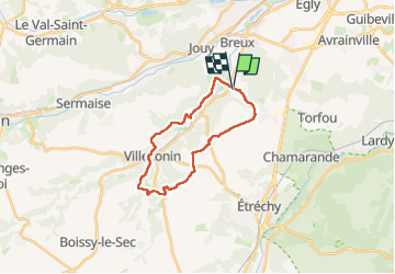

Length
19.5 km

Max alt
154 m

Uphill gradient
288 m
Km-Effort
23 km

Min alt
67 m

Downhill gradient
291 m
Boucle
Yes
Creation date :
2023-05-27 07:15:47.878
Updated on :
2023-05-28 08:12:34.829
6h22
Difficulty : Medium

FREE GPS app for hiking
 SityTrail
IGN / Geographical institutes
SityTrail Plus
The world is yours!
About
Trail Walking of 19.5 km to be discovered at Ile-de-France, Essonne, Saint-Sulpice-de-Favières. This trail is proposed by CSR-94.
Positioning
Country:
France
Region :
Ile-de-France
Department/Province :
Essonne
Municipality :
Saint-Sulpice-de-Favières
Location:
Unknown
Start:(Dec)
Start:(UTM)
439080 ; 5376855 (31U) N.
Comments