


Les Bidoufles

soca
User
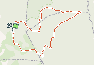

Length
13.7 km

Max alt
749 m

Uphill gradient
408 m
Km-Effort
19.2 km

Min alt
598 m

Downhill gradient
414 m
Boucle
Yes
Creation date :
2016-11-09 00:00:00.0
Updated on :
2016-11-09 00:00:00.0
5h00
Difficulty : Medium

FREE GPS app for hiking
 SityTrail
IGN / Geographical institutes
SityTrail Plus
The world is yours!
About
Trail Walking of 13.7 km to be discovered at Provence-Alpes-Côte d'Azur, Var, Signes. This trail is proposed by soca.
Positioning
Country:
France
Region :
Provence-Alpes-Côte d'Azur
Department/Province :
Var
Municipality :
Signes
Location:
Unknown
Start:(Dec)
Start:(UTM)
737140 ; 4790544 (31T) N.
Comments