


Boucle au départ d’engins

choubaka77
User
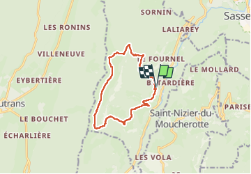

Length
11.6 km

Max alt
1604 m

Uphill gradient
739 m
Km-Effort
21 km

Min alt
920 m

Downhill gradient
741 m
Boucle
Yes
Creation date :
2023-05-28 10:01:30.0
Updated on :
2023-05-28 14:46:06.032
4h19
Difficulty : Medium

FREE GPS app for hiking
 SityTrail
IGN / Geographical institutes
SityTrail Plus
The world is yours!
About
Trail Walking of 11.6 km to be discovered at Auvergne-Rhône-Alpes, Isère, Engins. This trail is proposed by choubaka77.
Description
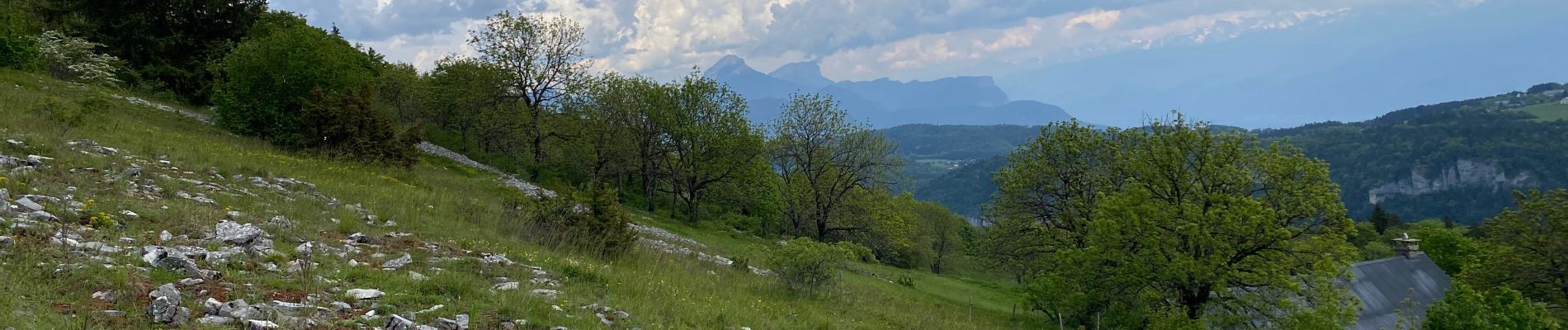
Pour amateur de flore et de paysage au mois de mai !
Photos


Positioning
Country:
France
Region :
Auvergne-Rhône-Alpes
Department/Province :
Isère
Municipality :
Engins
Location:
Unknown
Start:(Dec)
Start:(UTM)
705605 ; 5006441 (31T) N.
Comments