


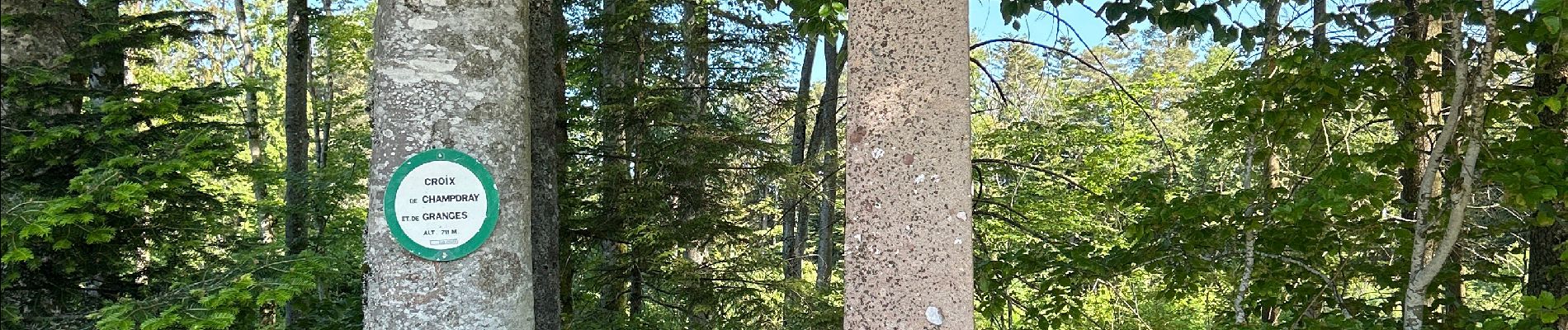
Champdray, point de vue de Laleu

francoisecarlier
User
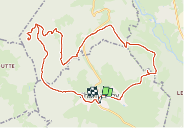

Length
12.6 km

Max alt
748 m

Uphill gradient
386 m
Km-Effort
17.8 km

Min alt
568 m

Downhill gradient
386 m
Boucle
Yes
Creation date :
2023-05-29 07:51:17.0
Updated on :
2023-05-29 11:13:04.9
3h21
Difficulty : Easy

FREE GPS app for hiking
 SityTrail
IGN / Geographical institutes
SityTrail Plus
The world is yours!
About
Trail Walking of 12.6 km to be discovered at Grand Est, Vosges, Champdray. This trail is proposed by francoisecarlier.
Photos

Positioning
Country:
France
Region :
Grand Est
Department/Province :
Vosges
Municipality :
Champdray
Location:
Unknown
Start:(Dec)
Start:(UTM)
332893 ; 5333680 (32U) N.
Comments