Trail Walking Unknown - Randonnée sur les plateaux au dessus du village de Moulins -Chérier - Photo

Randonnée sur les plateaux au dessus du village de Moulins -Chérier

 dudu42
dudu42

User

© OpenStreetMap contributors
Length
Length
17.7 km
Max alt
Max alt
1077 m
Uphill gradient
Uphill gradient
567 m
Km-Effort
Km-Effort  
25 km
Min alt
Min alt
666 m
Downhill gradient
Downhill gradient
565 m
Boucle
Boucle
Yes
Creation date :
2023-05-29 06:57:27.508
Updated on :
2023-05-29 11:35:21.819

(0 Reviews)

Walking
Walking
4h18
Difficulty : Medium

Scan this QR Code to open this trail in the SityTrail application

FREE GPS app for hiking

Logo SityTrail SityTrail

IGN / Geographical institutes

Download SityTrail from the App Store Download SityTrail from Google Play

Logo SityTrail SityTrail World

The world is yours!

Download SityTrail from the App Store Download SityTrail from Google Play Download SityTrail on Huawei AppGallery

About

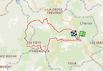
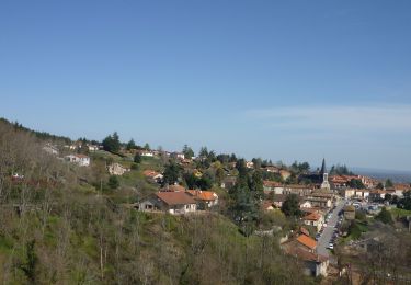
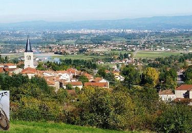
Trail Walking of 17.7 km to be discovered at Auvergne-Rhône-Alpes, Loire. This trail is proposed by dudu42.

Description

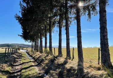
Parcours alternant bitume et chemins herbeux, et une grande partie du dénivelé positif est effectué au début de la randonnée.
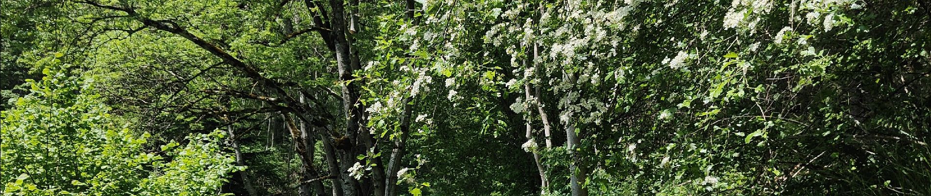
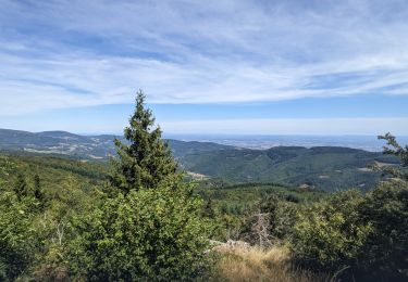
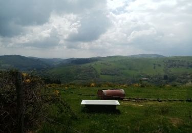
Très beaux points de vue au long du parcours.Rytmée au son des cricris(grillons)et des oiseaux c'est une belle ballade bucolique parfumée au senteurs du printemps. Un petit air est le bienvenu sur le plateau ! . Pensez à un couvre chef et a de la crème solaire

Elevation profile

Photos

30 photos in total. Please click on a photo to see them all in the gallery.

Positioning

Country:
France
Region :
Auvergne-Rhône-Alpes
Department/Province :
Loire
Municipality :
Unknown
Location:
Unknown
Start:(UTM)
570462 ; 5090590 (31T) N.

Trails nearby

Trail sport Saint-Jean-Saint-Maurice-sur-Loire - Retour bis - Photo
sport
ophness

sport

Very easy
(1)
Saint-Jean-Saint-Maurice-sur-Loire, Auvergne-Rhône-Alpes, Loire, France
12.6 km | 16.2 km-effort
Unknown
No
Trail Walking Cherier - rocher de rochefort depuis la croix Trévingt - Photo
Walking
famillerudent

Walking

Easy
Cherier, Auvergne-Rhône-Alpes, Loire, France
9.3 km | 13.4 km-effort
3h 10min
Yes
Trail Walking Arcon - Arcon: Roche Corbière-Quatre Murs - Photo
Walking
Jgar

Walking

Difficult
Arcon, Auvergne-Rhône-Alpes, Loire, France
18.2 km | 29 km-effort
6h 32min
Yes
Trail Walking Cherier - rando à Moulin Charier - Photo
Walking
mimi69670

Walking

Medium
Cherier, Auvergne-Rhône-Alpes, Loire, France
13.3 km | 18.6 km-effort
3h 29min
No
Trail Walking Villemontais - Villemontais : Chérier et Haut Ste-Agathe - Photo
Walking
Jgar

Walking

Difficult
Villemontais, Auvergne-Rhône-Alpes, Loire, France
15.1 km | 23 km-effort
4h 22min
Yes
Trail Walking Cherier - Les Moulins Chérier : entre Les Faux et Montloup - Photo
Walking
Jgar

Walking

Medium
Cherier, Auvergne-Rhône-Alpes, Loire, France
8.5 km | 10.9 km-effort
2h 30min
Yes
Trail On foot Cherier - Les Moulins Chérier - boucles autour du vieux bourg - Photo
On foot
Jgar

On foot

Easy
Cherier, Auvergne-Rhône-Alpes, Loire, France
8.6 km | 12.5 km-effort
2h 50min
Yes
Trail Walking Saint-Alban-les-Eaux - Saint Alban les Eaux - Photo
Walking
jpc42

Walking

Medium
Saint-Alban-les-Eaux, Auvergne-Rhône-Alpes, Loire, France
13.1 km | 19.5 km-effort
3h 10min
Yes
Trail Mountain bike Villemontais - VTT Sportif au Pays d'Urfé (avec Pat et Manu) - Villemontais - Photo
Mountain bike
tracegps

Mountain bike

Very difficult
Villemontais, Auvergne-Rhône-Alpes, Loire, France
51 km | 69 km-effort
4h 40min
Yes


Close
My subscriptions