


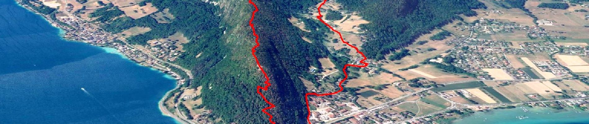
Boucle du Taillefer

affinetataille
User GUIDE
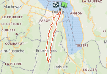

Length
11.3 km

Max alt
867 m

Uphill gradient
479 m
Km-Effort
17.6 km

Min alt
452 m

Downhill gradient
480 m
Boucle
Yes
Creation date :
2023-05-29 07:34:50.583
Updated on :
2023-06-03 16:14:07.57
4h00
Difficulty : Medium

FREE GPS app for hiking
 SityTrail
IGN / Geographical institutes
SityTrail Plus
The world is yours!
About
Trail Walking of 11.3 km to be discovered at Auvergne-Rhône-Alpes, Upper Savoy, Duingt. This trail is proposed by affinetataille.
Photos


33 photos in total. Please click on a photo to see them all in the gallery.
Positioning
Country:
France
Region :
Auvergne-Rhône-Alpes
Department/Province :
Upper Savoy
Municipality :
Duingt
Location:
Unknown
Start:(Dec)
Start:(UTM)
282899 ; 5078737 (32T) N.
Comments