


La Lunetteen circuit

Emelle
User
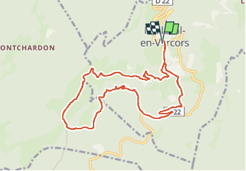

Length
11.1 km

Max alt
1322 m

Uphill gradient
469 m
Km-Effort
17.4 km

Min alt
928 m

Downhill gradient
468 m
Boucle
Yes
Creation date :
2020-08-27 07:08:50.096
Updated on :
2023-05-29 14:18:31.246
4h56
Difficulty : Easy

FREE GPS app for hiking
 SityTrail
IGN / Geographical institutes
SityTrail Plus
The world is yours!
About
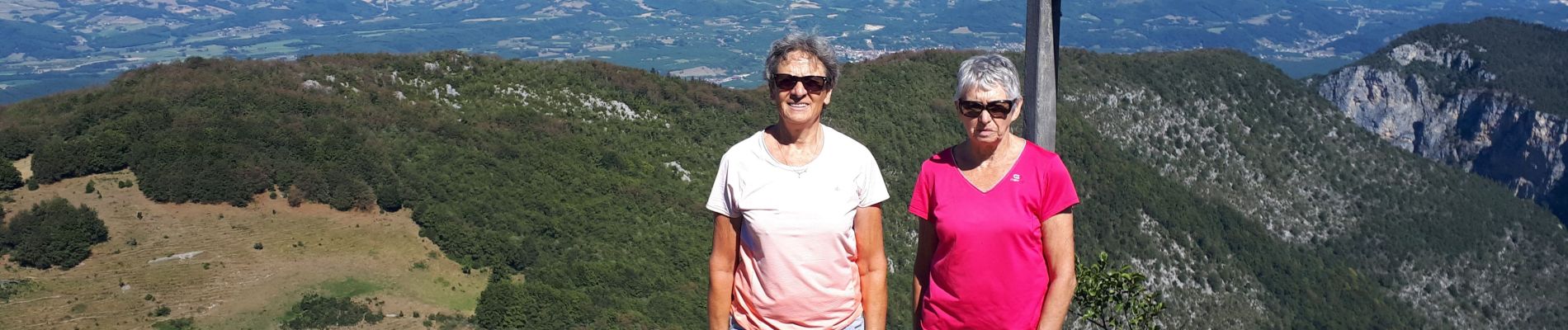
Trail Walking of 11.1 km to be discovered at Auvergne-Rhône-Alpes, Isère, Malleval-en-Vercors. This trail is proposed by Emelle.
Photos


Positioning
Country:
France
Region :
Auvergne-Rhône-Alpes
Department/Province :
Isère
Municipality :
Malleval-en-Vercors
Location:
Unknown
Start:(Dec)
Start:(UTM)
691590 ; 5002084 (31T) N.
Comments