


Mont Concors Taulisson

harydh
User GUIDE
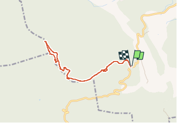

Length
8.4 km

Max alt
771 m

Uphill gradient
365 m
Km-Effort
13.3 km

Min alt
402 m

Downhill gradient
366 m
Boucle
Yes
Creation date :
2023-05-31 11:50:07.633
Updated on :
2023-05-31 11:53:22.041
2h45
Difficulty : Easy

FREE GPS app for hiking
 SityTrail
IGN / Geographical institutes
SityTrail Plus
The world is yours!
About
Trail Walking of 8.4 km to be discovered at Provence-Alpes-Côte d'Azur, Bouches-du-Rhône, Jouques. This trail is proposed by harydh.
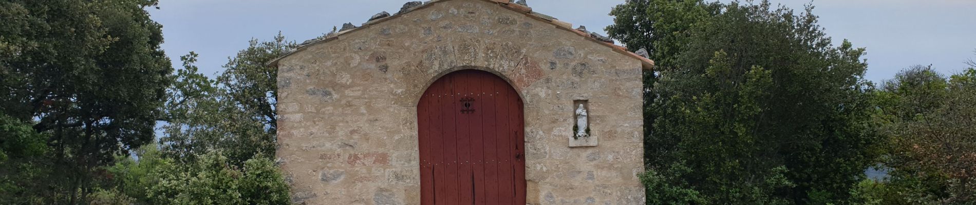
Photos


Positioning
Country:
France
Region :
Provence-Alpes-Côte d'Azur
Department/Province :
Bouches-du-Rhône
Municipality :
Jouques
Location:
Unknown
Start:(Dec)
Start:(UTM)
713351 ; 4829840 (31T) N.
Comments