


le Clignon

VANDERPUTTENMi
User GUIDE
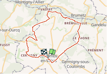

Length
18.1 km

Max alt
169 m

Uphill gradient
292 m
Km-Effort
22 km

Min alt
68 m

Downhill gradient
289 m
Boucle
Yes
Creation date :
2023-06-01 07:26:38.055
Updated on :
2023-06-02 19:08:16.912
4h58
Difficulty : Very difficult

FREE GPS app for hiking
 SityTrail
IGN / Geographical institutes
SityTrail Plus
The world is yours!
About
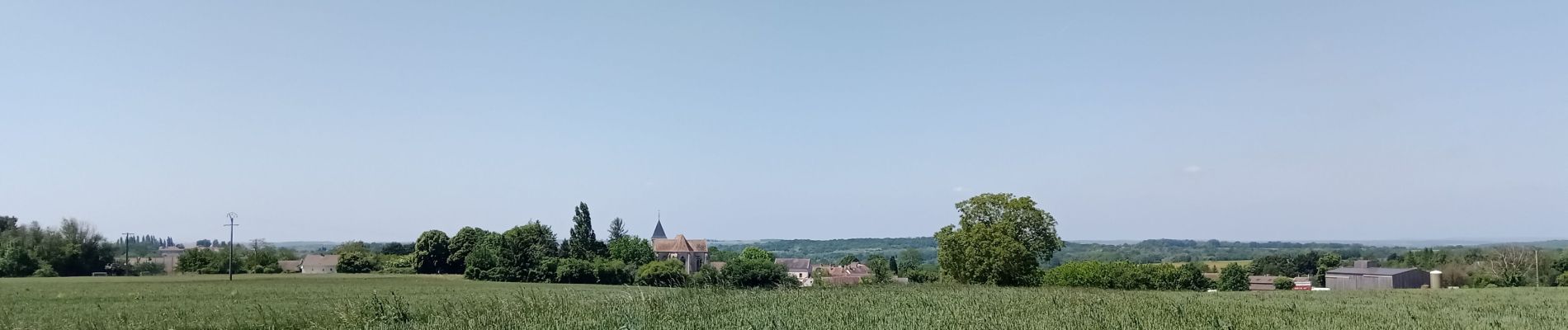
Trail Walking of 18.1 km to be discovered at Ile-de-France, Seine-et-Marne, Coulombs-en-Valois. This trail is proposed by VANDERPUTTENMi.
Photos


Positioning
Country:
France
Region :
Ile-de-France
Department/Province :
Seine-et-Marne
Municipality :
Coulombs-en-Valois
Location:
Unknown
Start:(Dec)
Start:(UTM)
509174 ; 5435138 (31U) N.
Comments