


Rougemont le Château-Chapelle St Catherine-le Sudel-Oberen Grambaechle- les trois Bornes-Rougemont

patrickbeyrath
User
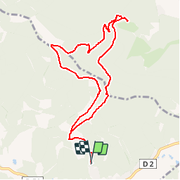

Length
9.7 km

Max alt
912 m

Uphill gradient
542 m
Km-Effort
16.9 km

Min alt
500 m

Downhill gradient
543 m
Boucle
Yes
Creation date :
2018-10-13 05:52:53.566
Updated on :
2018-10-13 05:52:53.58
3h30
Difficulty : Medium

FREE GPS app for hiking
 SityTrail
IGN / Geographical institutes
SityTrail Plus
The world is yours!
About
Trail Walking of 9.7 km to be discovered at Bourgogne-Franche-Comté, Territoire-de-Belfort, Rougemont-le-Château. This trail is proposed by patrickbeyrath.
Positioning
Country:
France
Region :
Bourgogne-Franche-Comté
Department/Province :
Territoire-de-Belfort
Municipality :
Rougemont-le-Château
Location:
Unknown
Start:(Dec)
Start:(UTM)
347620 ; 5289439 (32T) N.
Comments