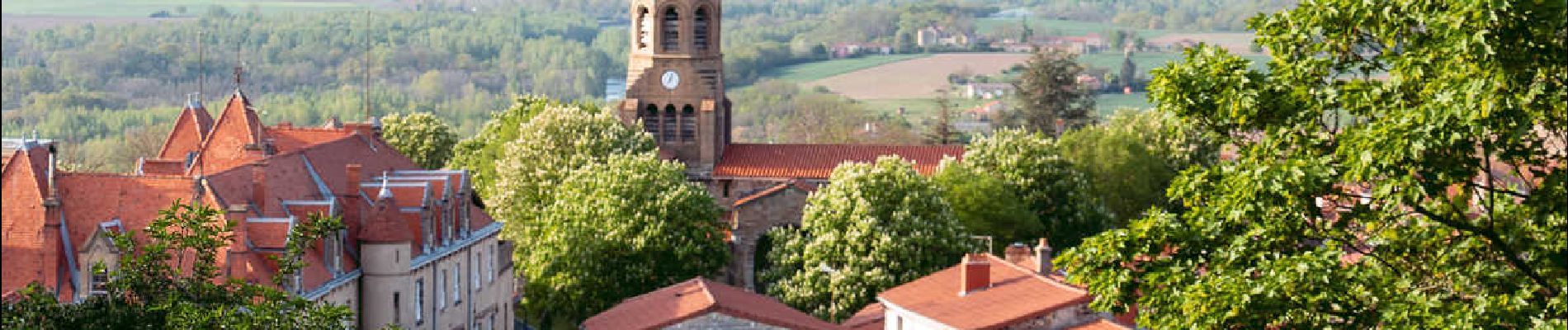
Trail Walking Nonette-Orsonnette - Nonette_Val_Allier - Photo
 jagarnier
jagarnier

User GUIDE

© OpenStreetMap contributors
Length
Length
9.9 km
Max alt
Max alt
551 m
Uphill gradient
Uphill gradient
264 m
Km-Effort
Km-Effort  
13.4 km
Min alt
Min alt
389 m
Downhill gradient
Downhill gradient
268 m
Boucle
Boucle
Yes
Creation date :
2023-06-05 07:26:36.016
Updated on :
2023-06-07 07:08:06.581

(1 Reviews)

Walking
Walking
3h00
Difficulty : Medium

Scan this QR Code to open this trail in the SityTrail application

FREE GPS app for hiking

Logo SityTrail SityTrail

IGN / Geographical institutes

Download SityTrail from the App Store Download SityTrail from Google Play

Logo SityTrail SityTrail Plus

The world is yours!

Download SityTrail from the App Store Download SityTrail from Google Play Download SityTrail on Huawei AppGallery

About

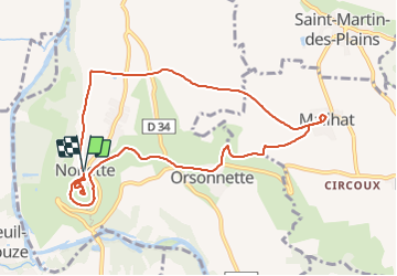
Trail Walking of 9.9 km to be discovered at Auvergne-Rhône-Alpes, Puy-de-Dôme, Nonette-Orsonnette. This trail is proposed by jagarnier.

Description

Le village de Nonette se trouve perché sur une butte volcanique surplombant une boucle de l'Allier. Au sommet de l'ancien volcan vous découvrirez une vue à 360° sur le Lembron et le val d'Allier. Tout au long du parcours, vous traverserez de jolis villages riches de leur culture et de leur histoire.

Elevation profile

Photos

Positioning

Country:
France
Region :
Auvergne-Rhône-Alpes
Department/Province :
Puy-de-Dôme
Municipality :
Nonette-Orsonnette
Location:
Nonette
Start:(UTM)
521790 ; 5035827 (31T) N.

Comments

Please log in to post a review or rate the element


Close
My subscriptions