


Wikiloc - Gambais - Marsauceux

olivieraron
User
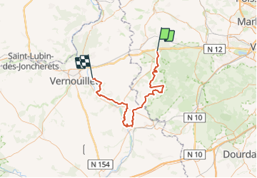

Length
68 km

Max alt
189 m

Uphill gradient
672 m
Km-Effort
77 km

Min alt
83 m

Downhill gradient
671 m
Boucle
No
Creation date :
2023-06-05 14:01:00.51
Updated on :
2023-06-05 14:23:52.712

FREE GPS app for hiking
 SityTrail
IGN / Geographical institutes
SityTrail Plus
The world is yours!
About
Trail of 68 km to be discovered at Ile-de-France, Yvelines, Gambais. This trail is proposed by olivieraron.
Positioning
Country:
France
Region :
Ile-de-France
Department/Province :
Yvelines
Municipality :
Gambais
Location:
Unknown
Start:(Dec)
Start:(UTM)
403477 ; 5405308 (31U) N.
Comments