


Randonner Autrement - Au fil de l'eau

bernir
User

Length
4.5 km

Max alt
380 m

Uphill gradient
132 m
Km-Effort
6.2 km

Min alt
301 m

Downhill gradient
133 m
Boucle
Yes
Creation date :
2023-06-07 06:30:26.472
Updated on :
2023-06-07 06:33:15.649
1h24
Difficulty : Easy

FREE GPS app for hiking
 SityTrail
IGN / Geographical institutes
SityTrail Plus
The world is yours!
About
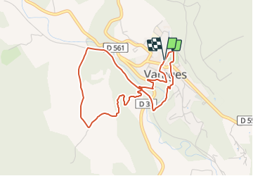
Trail Walking of 4.5 km to be discovered at Provence-Alpes-Côte d'Azur, Var, Varages. This trail is proposed by bernir.
Positioning
Country:
France
Region :
Provence-Alpes-Côte d'Azur
Department/Province :
Var
Municipality :
Varages
Location:
Unknown
Start:(Dec)
Start:(UTM)
738944 ; 4831478 (31T) N.
Comments