


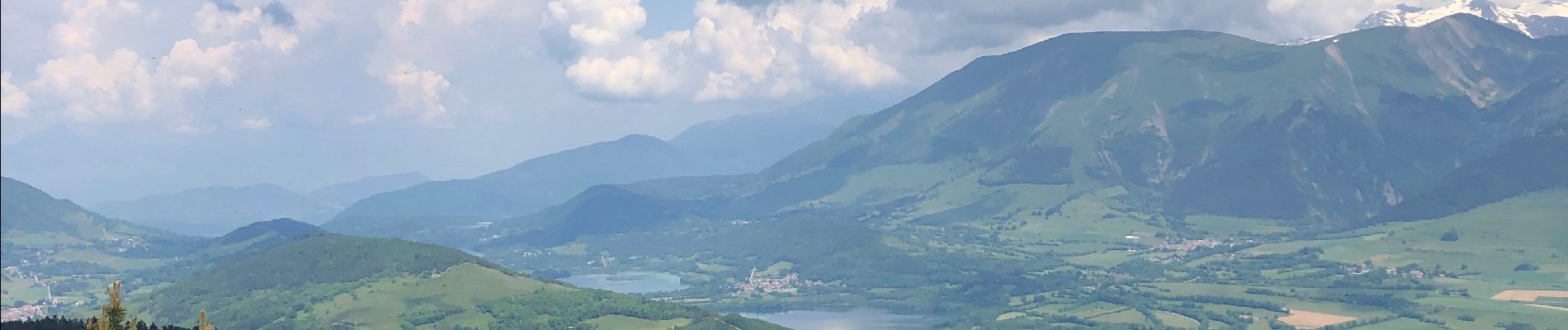
Peyrouse signaraux 56 km 2200 d+

starco
User
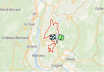

Length
55 km

Max alt
1707 m

Uphill gradient
2128 m
Km-Effort
83 km

Min alt
893 m

Downhill gradient
2128 m
Boucle
Yes
Creation date :
2023-06-07 06:31:55.0
Updated on :
2023-06-07 12:47:43.39
5h50
Difficulty : Difficult

FREE GPS app for hiking
 SityTrail
IGN / Geographical institutes
SityTrail Plus
The world is yours!
About
Trail Mountain bike of 55 km to be discovered at Auvergne-Rhône-Alpes, Isère, Pierre-Châtel. This trail is proposed by starco.
Photos


Positioning
Country:
France
Region :
Auvergne-Rhône-Alpes
Department/Province :
Isère
Municipality :
Pierre-Châtel
Location:
Unknown
Start:(Dec)
Start:(UTM)
719047 ; 4981607 (31T) N.
Comments