


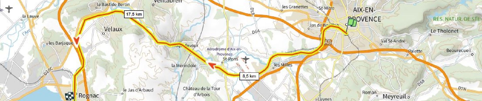
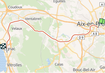
Voie SNCF Aix Rognac

ericberlin
User

Length
26 km

Max alt
199 m

Uphill gradient
220 m
Km-Effort
29 km

Min alt
18 m

Downhill gradient
372 m
Boucle
No
Creation date :
2023-06-07 14:45:58.055
Updated on :
2023-06-07 14:49:43.626
0m
Difficulty : Very easy

FREE GPS app for hiking
 SityTrail
IGN / Geographical institutes
SityTrail Plus
The world is yours!
About
Trail Other activity of 26 km to be discovered at Provence-Alpes-Côte d'Azur, Bouches-du-Rhône, Aix-en-Provence. This trail is proposed by ericberlin.
Description
https://fr.wikipedia.org/wiki/Ligne_de_Rognac_à_Aix-en-Provence
Photos

Positioning
Country:
France
Region :
Provence-Alpes-Côte d'Azur
Department/Province :
Bouches-du-Rhône
Municipality :
Aix-en-Provence
Location:
Unknown
Start:(Dec)
Start:(UTM)
697616 ; 4821766 (31T) N.
Comments