


la Montagnette par le Grand Pas

bymarc26
User
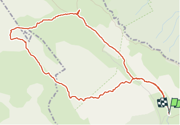

Length
6.7 km

Max alt
1957 m

Uphill gradient
502 m
Km-Effort
13.4 km

Min alt
1463 m

Downhill gradient
504 m
Boucle
Yes
Creation date :
2023-06-07 07:45:14.671
Updated on :
2023-06-07 16:43:12.91
2h22
Difficulty : Difficult

FREE GPS app for hiking
 SityTrail
IGN / Geographical institutes
SityTrail Plus
The world is yours!
About
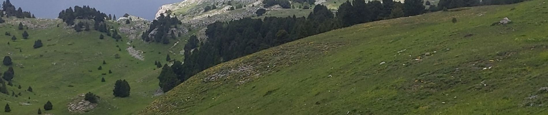
Trail Walking of 6.7 km to be discovered at Auvergne-Rhône-Alpes, Drôme, Châtillon-en-Diois. This trail is proposed by bymarc26.
Description
le passage du grand pas nécessite de mettre les mains voire une corde pour rassurer les moins à l'aise
Photos


Positioning
Country:
France
Region :
Auvergne-Rhône-Alpes
Department/Province :
Drôme
Municipality :
Châtillon-en-Diois
Location:
Treschenu-Creyers
Start:(Dec)
Start:(UTM)
703637 ; 4961171 (31T) N.
Comments