


Coulombs

VANDERPUTTENMi
User GUIDE

Length
38 m

Max alt
70 m

Uphill gradient
0 m
Km-Effort
38 m

Min alt
70 m

Downhill gradient
0 m
Boucle
No
Creation date :
2023-06-08 12:49:33.701
Updated on :
2023-06-08 17:25:26.713
47m
Difficulty : Easy

FREE GPS app for hiking
 SityTrail
IGN / Geographical institutes
SityTrail Plus
The world is yours!
About
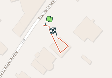
Trail Walking of 38 m to be discovered at Hauts-de-France, Aisne, Château-Thierry. This trail is proposed by VANDERPUTTENMi.
Positioning
Country:
France
Region :
Hauts-de-France
Department/Province :
Aisne
Municipality :
Château-Thierry
Location:
Unknown
Start:(Dec)
Start:(UTM)
527945 ; 5431973 (31U) N.
Comments