


Boreon, Refuge Cougourde, Lac Trecolpas

GrouGary
User
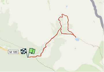


3h39
Difficulty : Difficult

FREE GPS app for hiking
 SityTrail
IGN / Geographical institutes
SityTrail Plus
The world is yours!
About
Trail Walking of 9.2 km to be discovered at Provence-Alpes-Côte d'Azur, Maritime Alps, Saint-Martin-Vésubie. This trail is proposed by GrouGary.
Description
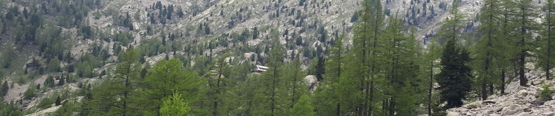
Petite boucle dans le vallon du haut Boréon, laissant la voiture au parking haut b.420 (route un peu défoncée sur le haut)
Montée le long du torrent, rive droite ou gauche, que l'on enjambe sur des ponts de bois. Bugles pyramidales, rhododendrons...
Très nombreux bouquetins peu farouches autour du Refuge de la Cougourde.
Cheminement sur un gros pierrier très "aménagé jusqu'au magique Lac de Trecolpas et sa petite île. Bouquetins.
Photos


Positioning
Comments