


Rando claix 51 km 1900d+

starco
User
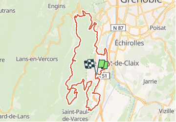

Length
50 km

Max alt
1368 m

Uphill gradient
1977 m
Km-Effort
77 km

Min alt
233 m

Downhill gradient
1976 m
Boucle
Yes
Creation date :
2023-06-10 05:57:18.0
Updated on :
2023-06-10 10:39:53.423
4h39
Difficulty : Very difficult

FREE GPS app for hiking
 SityTrail
IGN / Geographical institutes
SityTrail Plus
The world is yours!
About
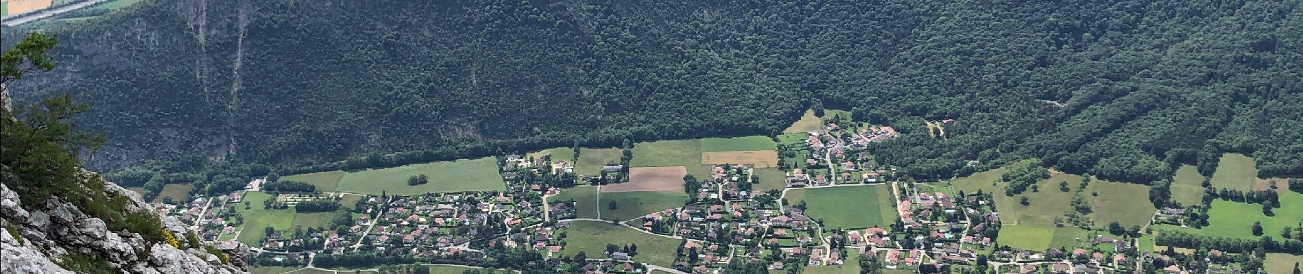
Trail Mountain bike of 50 km to be discovered at Auvergne-Rhône-Alpes, Isère, Claix. This trail is proposed by starco.
Photos


Positioning
Country:
France
Region :
Auvergne-Rhône-Alpes
Department/Province :
Isère
Municipality :
Claix
Location:
Unknown
Start:(Dec)
Start:(UTM)
710278 ; 4998835 (31T) N.
Comments