


Lay saint Remy

sandra54570
User
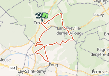

Length
14.8 km

Max alt
389 m

Uphill gradient
264 m
Km-Effort
18.3 km

Min alt
252 m

Downhill gradient
265 m
Boucle
Yes
Creation date :
2014-12-13 00:00:00.0
Updated on :
2014-12-13 00:00:00.0
2h00
Difficulty : Medium

FREE GPS app for hiking
 SityTrail
IGN / Geographical institutes
SityTrail Plus
The world is yours!
About
Trail Equestrian of 14.8 km to be discovered at Grand Est, Meurthe-et-Moselle, Trondes. This trail is proposed by sandra54570.
Positioning
Country:
France
Region :
Grand Est
Department/Province :
Meurthe-et-Moselle
Municipality :
Trondes
Location:
Unknown
Start:(Dec)
Start:(UTM)
703946 ; 5399623 (31U) N.
Comments