


GR 10 01

chasle
User
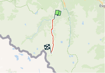

Length
8.2 km

Max alt
2155 m

Uphill gradient
698 m
Km-Effort
15.3 km

Min alt
1467 m

Downhill gradient
23 m
Boucle
No
Creation date :
2023-06-11 07:21:52.151
Updated on :
2023-06-11 07:22:29.797
3h28
Difficulty : Difficult

FREE GPS app for hiking
 SityTrail
IGN / Geographical institutes
SityTrail Plus
The world is yours!
About
Trail Walking of 8.2 km to be discovered at Occitania, Hautespyrenees, Cauterets. This trail is proposed by chasle.
Positioning
Country:
France
Region :
Occitania
Department/Province :
Hautespyrenees
Municipality :
Cauterets
Location:
Unknown
Start:(Dec)
Start:(UTM)
734033 ; 4748325 (30T) N.
Comments