


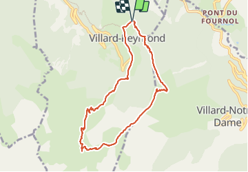
La Croix de Carellet

GioA10
User

Length
8.6 km

Max alt
2122 m

Uphill gradient
550 m
Km-Effort
15.9 km

Min alt
1608 m

Downhill gradient
546 m
Boucle
Yes
Creation date :
2023-06-11 06:01:55.0
Updated on :
2023-06-11 10:53:35.544
4h00
Difficulty : Easy

FREE GPS app for hiking
 SityTrail
IGN / Geographical institutes
SityTrail Plus
The world is yours!
About
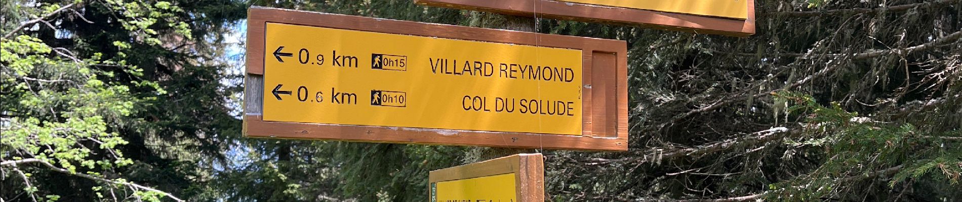
Trail Walking of 8.6 km to be discovered at Auvergne-Rhône-Alpes, Isère, Villard-Reymond. This trail is proposed by GioA10.
Photos


Positioning
Country:
France
Region :
Auvergne-Rhône-Alpes
Department/Province :
Isère
Municipality :
Villard-Reymond
Location:
Unknown
Start:(Dec)
Start:(UTM)
265263 ; 4991302 (32T) N.
Comments