


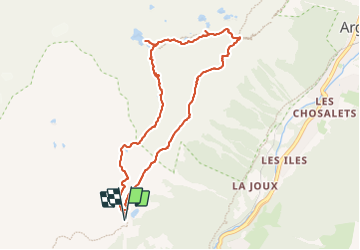
Depuis le télécabine de La Flégère jusqu'au refuge et Lac Blanc et descente bouclée par les Lacs des Chéserys

ScarniereLaurent
User


3h22
Difficulty : Medium

FREE GPS app for hiking
 SityTrail
IGN / Geographical institutes
SityTrail Plus
The world is yours!
About
Trail Walking of 8.8 km to be discovered at Auvergne-Rhône-Alpes, Upper Savoy, Chamonix-Mont-Blanc. This trail is proposed by ScarniereLaurent.
Description
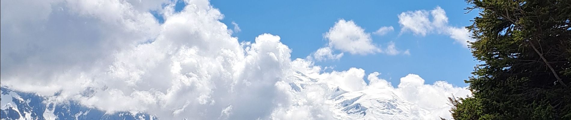
Superbe randonnée en réserve naturelle des Aiguilles Rouges réalisée en début de saison avec beaucoup de névés à traverser autour des lacs et au refuge. Splendides points de vue sur le Massif du Mont-Blanc, les Drus, la mer de glace...
Photos


Positioning
Comments