


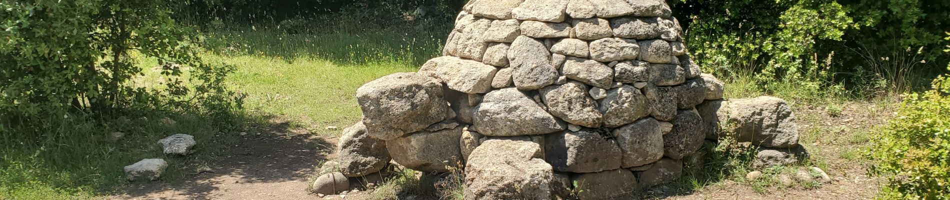
ganagobie auges 683m 21kms

Danielba
User GUIDE

Length
19.9 km

Max alt
773 m

Uphill gradient
684 m
Km-Effort
29 km

Min alt
405 m

Downhill gradient
687 m
Boucle
Yes
Creation date :
2023-06-11 06:21:59.843
Updated on :
2023-06-11 16:13:24.407
6h45
Difficulty : Easy

FREE GPS app for hiking
 SityTrail
IGN / Geographical institutes
SityTrail Plus
The world is yours!
About
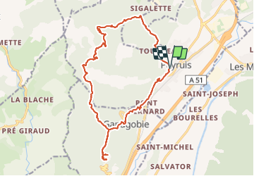
Trail Walking of 19.9 km to be discovered at Provence-Alpes-Côte d'Azur, Alpes-de-Haute-Provence, Peyruis. This trail is proposed by Danielba .
Photos


Positioning
Country:
France
Region :
Provence-Alpes-Côte d'Azur
Department/Province :
Alpes-de-Haute-Provence
Municipality :
Peyruis
Location:
Unknown
Start:(Dec)
Start:(UTM)
735453 ; 4879260 (31T) N.
Comments