Trail Walking Consdorf - 2023-06-13_20h03m09_Circuit_auto-pdestre_Consdorf_-_Mullerthal - Photo

2023-06-13_20h03m09_Circuit_auto-pdestre_Consdorf_-_Mullerthal

© OpenStreetMap contributors
Length
Length
9 km
Max alt
Max alt
349 m
Uphill gradient
Uphill gradient
249 m
Km-Effort
Km-Effort  
12.3 km
Min alt
Min alt
211 m
Downhill gradient
Downhill gradient
241 m
Boucle
Boucle
Yes
Creation date :
2023-06-13 18:03:09.568
Updated on :
2023-06-24 14:33:55.047

(1 Reviews)

Walking
Walking
2h48
Difficulty : Medium

Scan this QR Code to open this trail in the SityTrail application

FREE GPS app for hiking

Logo SityTrail SityTrail

IGN / Geographical institutes

Download SityTrail from the App Store Download SityTrail from Google Play

Logo SityTrail SityTrail World

The world is yours!

Download SityTrail from the App Store Download SityTrail from Google Play Download SityTrail on Huawei AppGallery

About

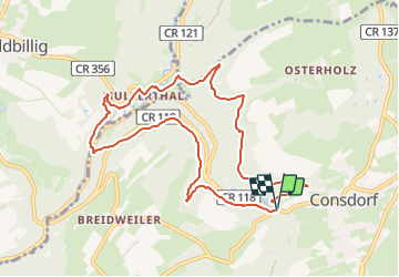
Trail Walking of 9 km to be discovered at Unknown, Canton Echternach, Consdorf. This trail is proposed by mumu.larandonneuse.

Description

Circuit Auto-pédestre.
💚 Coup de cœur pour cette randonnée 💚
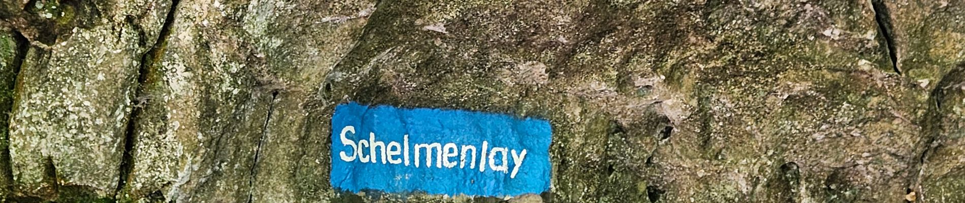
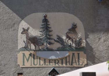
ℹ️ www.mullerthal-trail.lu
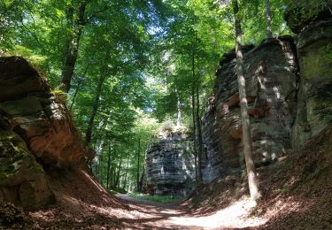
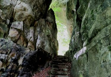
➡️ Cette randonnée exigeante relie les endroits de deux anciens moulins dans les villages de Consdorf et Mullerthal. Vous longez de fascinantes formations rocheuses.
...
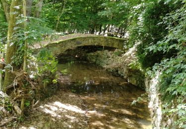
Le Schiessentümpel situé sur l'Ernz Noire est une cascade pittoresque que vous longez. La cascade est surplombée d'un pont idyllique en pierres et en bois. Avec les rochers environnants et la végétation luxuriante, le Schiessentümpel est devenu une des destinations d'excursion les plus populaires de la Région Mullerthal -  Petite Suisse luxembourgeoise.

Elevation profile

Photos

Positioning

Country:
Luxembourg
Region :
Unknown
Department/Province :
Canton Echternach
Municipality :
Consdorf
Location:
Unknown
Start:(UTM)
307631 ; 5517469 (32U) N.

Comments

Please log in to post a review or rate the element


Superbe rando 💚💚💚


Trails nearby

Trail Walking Consdorf - 2023-06-19_09h33m43_Sentier_local_-_C6 - Photo
Walking
GUIDE
mumu.larandonneuse

Walking

Medium
(1)
Consdorf, Unknown, Canton Echternach, Luxembourg
5.8 km | 7.3 km-effort
1h 39min
Yes
Trail Walking Consdorf - 2023-06-13_20h43m48_Sentier_local_-_C2 - Photo
Walking
GUIDE
mumu.larandonneuse

Walking

Easy
(1)
Consdorf, Unknown, Canton Echternach, Luxembourg
4.2 km | 5.5 km-effort
1h 15min
Yes
Trail Walking Berdorf - Berdorf - B2 - Müllerthal - Photo
Walking
GUIDE
mumu.larandonneuse

Walking

Medium
(1)
Berdorf, Unknown, Canton Echternach, Luxembourg
6.7 km | 8.5 km-effort
1h 35min
Yes
Trail Walking Consdorf - 2023-06-21_17h04m10_Sentier_local_-_C1 (1) - Photo
Walking
GUIDE
mumu.larandonneuse

Walking

Easy
(1)
Consdorf, Unknown, Canton Echternach, Luxembourg
1.9 km | 2.5 km-effort
34min
Yes
Trail Walking Waldbillig - Mullerthal randonnée magnifique - Photo
Walking
Alfredy

Walking

Difficult
(4)
Waldbillig, Unknown, Canton Echternach, Luxembourg
9.3 km | 12.9 km-effort
4h 21min
Yes
Trail Walking Waldbillig - MÜLLERTHAL (Cascades) - Photo
Walking
GerardBouche

Walking

Medium
(1)
Waldbillig, Unknown, Canton Echternach, Luxembourg
10.2 km | 13.7 km-effort
3h 1min
Yes
Trail Other activity Waldbillig - Luxemburg: Mullerthal - Consdorf - Mullerthal - Photo
Other activity
mikeryckmans

Other activity

Very difficult
(3)
Waldbillig, Unknown, Canton Echternach, Luxembourg
11.5 km | 15.4 km-effort
4h 10min
Yes
Trail Walking Waldbillig - 20220525 - Mullertal 11.7 Km - Photo
Walking
GUIDE
pierreh01

Walking

Medium
Waldbillig, Unknown, Canton Echternach, Luxembourg
11.7 km | 15.4 km-effort
4h 31min
Yes
Trail Walking Consdorf - Superbe promenade vers le Kuelscheier   - Photo
Walking
GUIDE+

Walking

Medium
(1)
Consdorf, Unknown, Canton Echternach, Luxembourg
6.6 km | 8.3 km-effort
1h 53min
Yes


Close
My subscriptions