


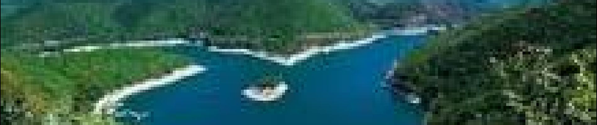
Le Réservoir d'Avène

ARVIEU
User
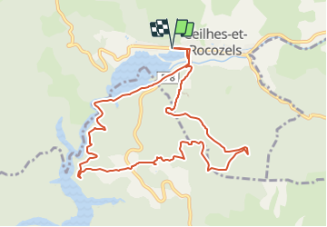

Length
11 km

Max alt
753 m

Uphill gradient
379 m
Km-Effort
16.1 km

Min alt
424 m

Downhill gradient
379 m
Boucle
Yes
Creation date :
2023-06-14 05:58:14.587
Updated on :
2023-06-14 05:59:20.225
4h00
Difficulty : Medium

FREE GPS app for hiking
 SityTrail
IGN / Geographical institutes
SityTrail Plus
The world is yours!
About
Trail Walking of 11 km to be discovered at Occitania, Hérault, Ceilhes-et-Rocozels. This trail is proposed by ARVIEU.
Photos

Points of interest


Positioning
Country:
France
Region :
Occitania
Department/Province :
Hérault
Municipality :
Ceilhes-et-Rocozels
Location:
Unknown
Start:(Dec)
Start:(UTM)
508510 ; 4850005 (31T) N.
Comments