


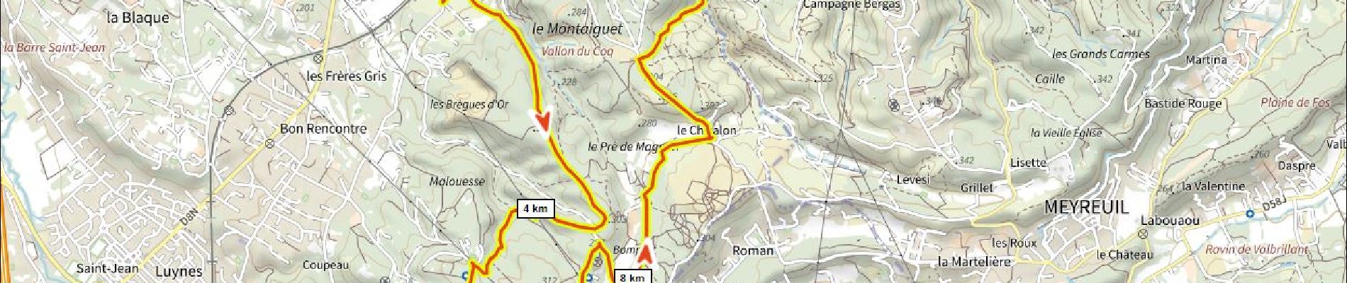
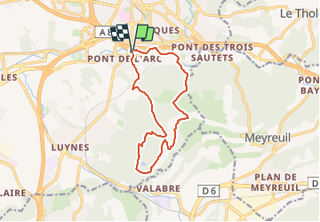
Tour du Montaiguet 340m+

ericberlin
User

Length
13.6 km

Max alt
313 m

Uphill gradient
339 m
Km-Effort
18.2 km

Min alt
131 m

Downhill gradient
339 m
Boucle
Yes
Creation date :
2023-06-14 16:32:25.322
Updated on :
2023-06-14 16:36:12.516
4h07
Difficulty : Difficult
1h15
Difficulty : Easy

FREE GPS app for hiking
 SityTrail
IGN / Geographical institutes
SityTrail Plus
The world is yours!
About
Trail Walking of 13.6 km to be discovered at Provence-Alpes-Côte d'Azur, Bouches-du-Rhône, Aix-en-Provence. This trail is proposed by ericberlin.
Photos

Positioning
Country:
France
Region :
Provence-Alpes-Côte d'Azur
Department/Province :
Bouches-du-Rhône
Municipality :
Aix-en-Provence
Location:
Unknown
Start:(Dec)
Start:(UTM)
697472 ; 4820400 (31T) N.
Comments