


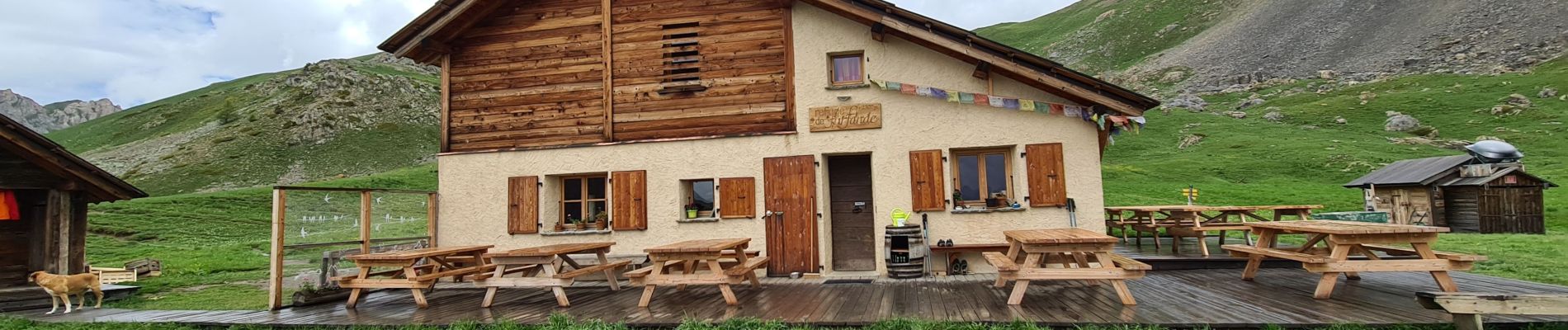
Queyras 02 - Arviieux/La Chalp - Refuge de Furfande

uru2010
User
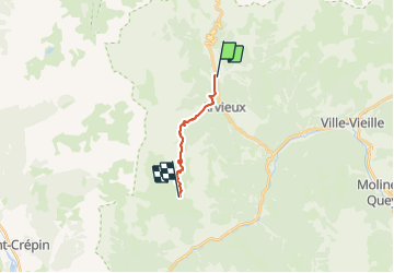

Length
10.1 km

Max alt
2500 m

Uphill gradient
912 m
Km-Effort
20 km

Min alt
1600 m

Downhill gradient
309 m
Boucle
No
Creation date :
2023-06-14 06:45:09.651
Updated on :
2023-06-15 15:24:40.59
4h59
Difficulty : Medium

FREE GPS app for hiking
 SityTrail
IGN / Geographical institutes
SityTrail Plus
The world is yours!
About
Trail Walking of 10.1 km to be discovered at Provence-Alpes-Côte d'Azur, Hautes-Alpes, Arvieux. This trail is proposed by uru2010.
Photos


Positioning
Country:
France
Region :
Provence-Alpes-Côte d'Azur
Department/Province :
Hautes-Alpes
Municipality :
Arvieux
Location:
Unknown
Start:(Dec)
Start:(UTM)
320816 ; 4961141 (32T) N.
Comments