


St Guilhem étape 4

darranger
User

Length
17 km

Max alt
1397 m

Uphill gradient
262 m
Km-Effort
22 km

Min alt
777 m

Downhill gradient
799 m
Boucle
No
Creation date :
2023-06-15 05:46:11.864
Updated on :
2023-06-16 13:15:18.092
4h32
Difficulty : Very difficult

FREE GPS app for hiking
 SityTrail
IGN / Geographical institutes
SityTrail Plus
The world is yours!
About
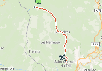
Trail Walking of 17 km to be discovered at Occitania, Lozère, Les Salces. This trail is proposed by darranger.
Positioning
Country:
France
Region :
Occitania
Department/Province :
Lozère
Municipality :
Les Salces
Location:
Unknown
Start:(Dec)
Start:(UTM)
507423 ; 4935885 (31T) N.
Comments