


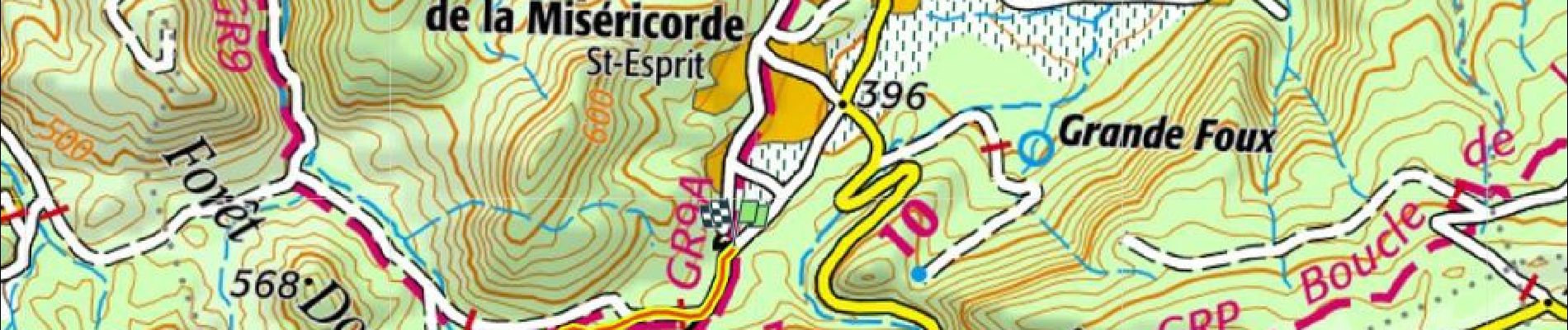
Source de l'Huveaune 100m+ depuis Nans

ericberlin
User
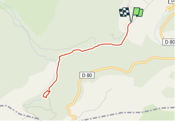

Length
4 km

Max alt
488 m

Uphill gradient
103 m
Km-Effort
5.4 km

Min alt
425 m

Downhill gradient
103 m
Boucle
Yes
Creation date :
2023-06-16 17:02:04.825
Updated on :
2023-06-16 17:18:55.494
1h13
Difficulty : Easy

FREE GPS app for hiking
 SityTrail
IGN / Geographical institutes
SityTrail Plus
The world is yours!
About
Trail Walking of 4 km to be discovered at Provence-Alpes-Côte d'Azur, Var, Nans-les-Pins. This trail is proposed by ericberlin.
Photos

Positioning
Country:
France
Region :
Provence-Alpes-Côte d'Azur
Department/Province :
Var
Municipality :
Nans-les-Pins
Location:
Unknown
Start:(Dec)
Start:(UTM)
725082 ; 4803978 (31T) N.
Comments