


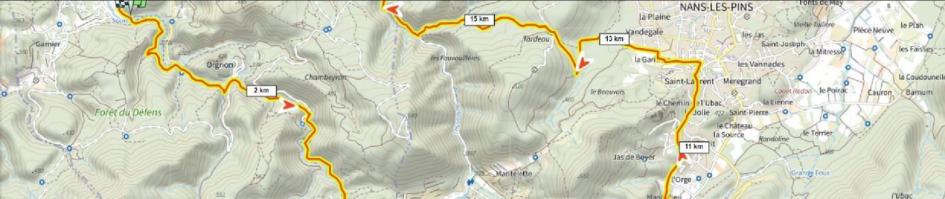
St Zacharie Nans 500m+ par les sources

ericberlin
User
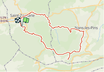

Length
21 km

Max alt
502 m

Uphill gradient
478 m
Km-Effort
28 km

Min alt
262 m

Downhill gradient
486 m
Boucle
Yes
Creation date :
2023-06-16 17:11:05.762
Updated on :
2023-06-16 17:17:34.497
2h10
Difficulty : Difficult

FREE GPS app for hiking
 SityTrail
IGN / Geographical institutes
SityTrail Plus
The world is yours!
About
Trail Mountain bike of 21 km to be discovered at Provence-Alpes-Côte d'Azur, Var, Saint-Zacharie. This trail is proposed by ericberlin.
Description
(tracé à essayer)
Photos

Positioning
Country:
France
Region :
Provence-Alpes-Côte d'Azur
Department/Province :
Var
Municipality :
Saint-Zacharie
Location:
Unknown
Start:(Dec)
Start:(UTM)
719374 ; 4805922 (31T) N.
Comments