


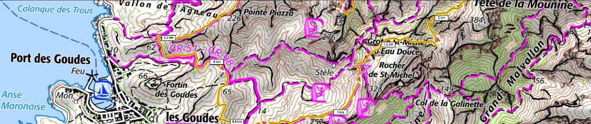
Marseilleveyre 520m+ sommet depuis Callelongue

ericberlin
User
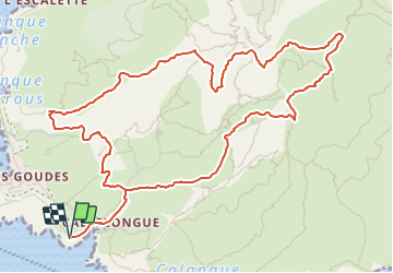

Length
7.2 km

Max alt
418 m

Uphill gradient
519 m
Km-Effort
14.1 km

Min alt
7 m

Downhill gradient
521 m
Boucle
Yes
Creation date :
2023-06-17 09:11:10.175
Updated on :
2023-06-17 09:16:25.561
3h12
Difficulty : Difficult

FREE GPS app for hiking
 SityTrail
IGN / Geographical institutes
SityTrail Plus
The world is yours!
About
Trail Walking of 7.2 km to be discovered at Provence-Alpes-Côte d'Azur, Bouches-du-Rhône, Marseille. This trail is proposed by ericberlin.
Photos

Positioning
Country:
France
Region :
Provence-Alpes-Côte d'Azur
Department/Province :
Bouches-du-Rhône
Municipality :
Marseille
Location:
8th Arrondissement
Start:(Dec)
Start:(UTM)
690974 ; 4787014 (31T) N.
Comments