


Chartreuse Chamechaude Écureuil v2

c.gourme
User
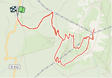

Length
8.8 km

Max alt
2040 m

Uphill gradient
716 m
Km-Effort
18.3 km

Min alt
1325 m

Downhill gradient
715 m
Boucle
Yes
Creation date :
2023-06-17 06:45:38.0
Updated on :
2023-06-18 14:32:25.288
4h09
Difficulty : Difficult

FREE GPS app for hiking
 SityTrail
IGN / Geographical institutes
SityTrail Plus
The world is yours!
About
Trail Walking of 8.8 km to be discovered at Auvergne-Rhône-Alpes, Isère, Sarcenas. This trail is proposed by c.gourme.
Description
Depuis la cabane de Baschasson, on quitte le sentier après un arbre mort il y a un cairn. voir repère
Positioning
Country:
France
Region :
Auvergne-Rhône-Alpes
Department/Province :
Isère
Municipality :
Sarcenas
Location:
Unknown
Start:(Dec)
Start:(UTM)
716979 ; 5018946 (31T) N.
Comments