Pic du Cagire

Prala
User
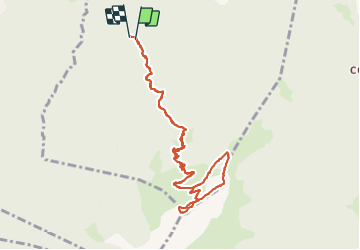

Length
10.7 km

Max alt
1899 m

Uphill gradient
985 m
Km-Effort
24 km

Min alt
967 m

Downhill gradient
996 m
Boucle
Yes
Creation date :
2023-06-17 06:44:01.957
Updated on :
2023-06-17 13:53:49.399
4h11
Difficulty : Medium

FREE GPS app for hiking
 SityTrail
IGN / Geographical institutes
SityTrail Plus
The world is yours!
About
Trail Walking of 10.7 km to be discovered at Occitania, Haute-Garonne, Juzet-d'Izaut. This trail is proposed by Prala.
Description
Pic du Cagire en boucle
Positioning
Country:
France
Region :
Occitania
Department/Province :
Haute-Garonne
Municipality :
Juzet-d'Izaut
Location:
Unknown
Start:(Dec)
Start:(UTM)
316546 ; 4759351 (31T) N.
Comments