


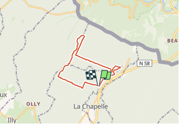
La chapelle.2023.06.18

trusgnachjf
User

Length
12.1 km

Max alt
417 m

Uphill gradient
230 m
Km-Effort
15.1 km

Min alt
303 m

Downhill gradient
233 m
Boucle
Yes
Creation date :
2023-06-18 07:30:38.449
Updated on :
2023-06-18 10:25:16.52
2h53
Difficulty : Difficult

FREE GPS app for hiking
 SityTrail
IGN / Geographical institutes
SityTrail Plus
The world is yours!
About
Trail Walking of 12.1 km to be discovered at Grand Est, Ardennes, Givonne. This trail is proposed by trusgnachjf.
Positioning
Country:
France
Region :
Grand Est
Department/Province :
Ardennes
Municipality :
Givonne
Location:
Unknown
Start:(Dec)
Start:(UTM)
645605 ; 5512950 (31U) N.
Comments