


Col du Pas de l’Ane et Pic de l’Ecalette

lebarça
User
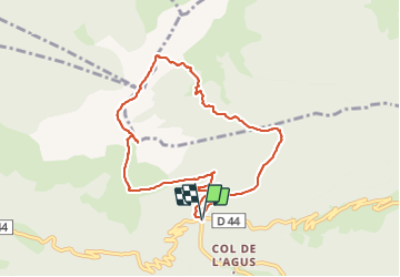

Length
9.2 km

Max alt
1843 m

Uphill gradient
577 m
Km-Effort
16.8 km

Min alt
1295 m

Downhill gradient
575 m
Boucle
Yes
Creation date :
2023-06-18 07:11:34.0
Updated on :
2023-06-18 12:29:25.927
5h16
Difficulty : Easy

FREE GPS app for hiking
 SityTrail
IGN / Geographical institutes
SityTrail Plus
The world is yours!
About
Trail Walking of 9.2 km to be discovered at Occitania, Haute-Garonne, Boutx. This trail is proposed by lebarça.
Positioning
Country:
France
Region :
Occitania
Department/Province :
Haute-Garonne
Municipality :
Boutx
Location:
Unknown
Start:(Dec)
Start:(UTM)
317333 ; 4754274 (31T) N.
Comments