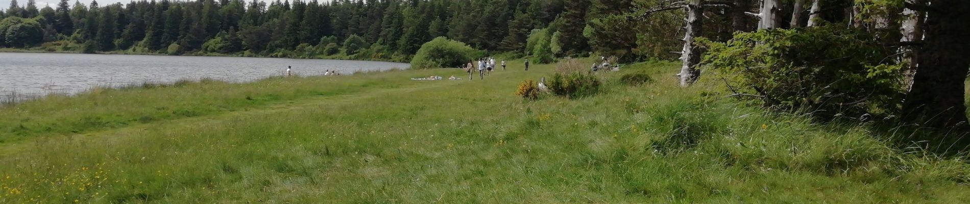
pessade Lac Serviere

Papou63patrick
User
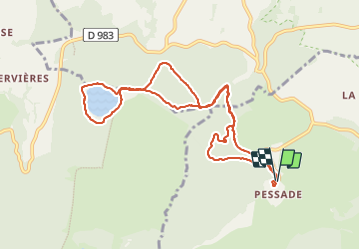

Length
10.2 km

Max alt
1221 m

Uphill gradient
229 m
Km-Effort
13.3 km

Min alt
1116 m

Downhill gradient
225 m
Boucle
Yes
Creation date :
2023-06-18 12:22:13.768
Updated on :
2023-06-18 15:51:21.463
2h30
Difficulty : Easy

FREE GPS app for hiking
 SityTrail
IGN / Geographical institutes
SityTrail Plus
The world is yours!
About
Trail Walking of 10.2 km to be discovered at Auvergne-Rhône-Alpes, Puy-de-Dôme, Saulzet-le-Froid. This trail is proposed by Papou63patrick.
Photos


Positioning
Country:
France
Region :
Auvergne-Rhône-Alpes
Department/Province :
Puy-de-Dôme
Municipality :
Saulzet-le-Froid
Location:
Unknown
Start:(Dec)
Start:(UTM)
491379 ; 5053651 (31T) N.
Comments