


Tête de l'Estrop et retour aux voitures

Clo0413
User
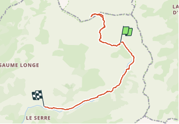

Length
16.7 km

Max alt
2938 m

Uphill gradient
909 m
Km-Effort
31 km

Min alt
1225 m

Downhill gradient
1712 m
Boucle
No
Creation date :
2023-06-18 05:04:53.586
Updated on :
2023-06-18 17:29:11.557
6h12
Difficulty : Difficult

FREE GPS app for hiking
 SityTrail
IGN / Geographical institutes
SityTrail Plus
The world is yours!
About
Trail Walking of 16.7 km to be discovered at Provence-Alpes-Côte d'Azur, Alpes-de-Haute-Provence, Prads-Haute-Bléone. This trail is proposed by Clo0413.
Positioning
Country:
France
Region :
Provence-Alpes-Côte d'Azur
Department/Province :
Alpes-de-Haute-Provence
Municipality :
Prads-Haute-Bléone
Location:
Prads
Start:(Dec)
Start:(UTM)
302472 ; 4905232 (32T) N.
Comments