


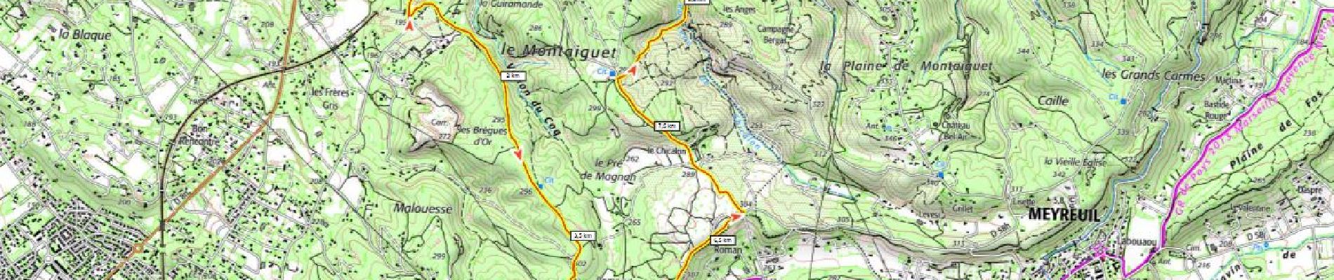
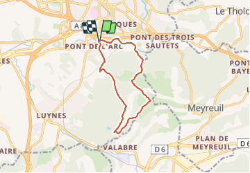
Montaiguet 275m depuis Pont de l'Arc (à essayer)

ericberlin
User

Length
11.7 km

Max alt
313 m

Uphill gradient
275 m
Km-Effort
15.3 km

Min alt
132 m

Downhill gradient
275 m
Boucle
Yes
Creation date :
2023-06-18 19:16:19.582
Updated on :
2023-06-19 19:07:52.625
3h28
Difficulty : Difficult

FREE GPS app for hiking
 SityTrail
IGN / Geographical institutes
SityTrail Plus
The world is yours!
About
Trail Walking of 11.7 km to be discovered at Provence-Alpes-Côte d'Azur, Bouches-du-Rhône, Aix-en-Provence. This trail is proposed by ericberlin.
Photos
 - Photo 1")
Positioning
Country:
France
Region :
Provence-Alpes-Côte d'Azur
Department/Province :
Bouches-du-Rhône
Municipality :
Aix-en-Provence
Location:
Unknown
Start:(Dec)
Start:(UTM)
697460 ; 4820384 (31T) N.
Comments