


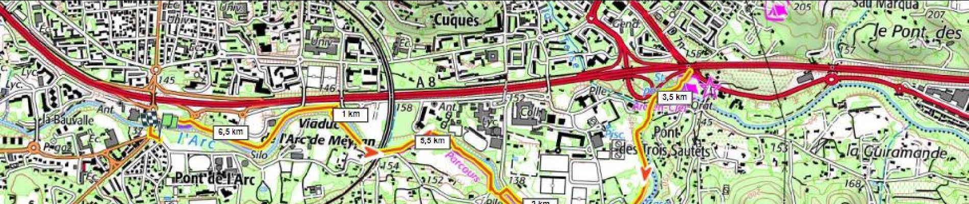
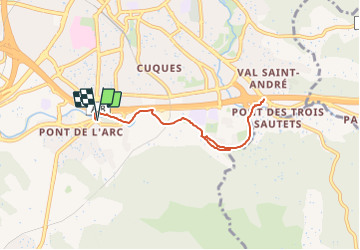
Bord de l'Arc, Pont de L'Arc au Pont des 3 Sautets

ericberlin
User

Length
6.9 km

Max alt
152 m

Uphill gradient
48 m
Km-Effort
7.6 km

Min alt
131 m

Downhill gradient
49 m
Boucle
Yes
Creation date :
2023-06-18 19:34:03.141
Updated on :
2023-06-18 19:40:04.369
1h43
Difficulty : Medium
1h00
Difficulty : Easy
31m
Difficulty : Easy
30m
Difficulty : Very easy

FREE GPS app for hiking
 SityTrail
IGN / Geographical institutes
SityTrail Plus
The world is yours!
About
Trail Walking of 6.9 km to be discovered at Provence-Alpes-Côte d'Azur, Bouches-du-Rhône, Aix-en-Provence. This trail is proposed by ericberlin.
Description
Promenade plate, aménagée, facile mais non goudronnée.
Parking au départ
Photos

Positioning
Country:
France
Region :
Provence-Alpes-Côte d'Azur
Department/Province :
Bouches-du-Rhône
Municipality :
Aix-en-Provence
Location:
Unknown
Start:(Dec)
Start:(UTM)
697451 ; 4820380 (31T) N.
Comments