


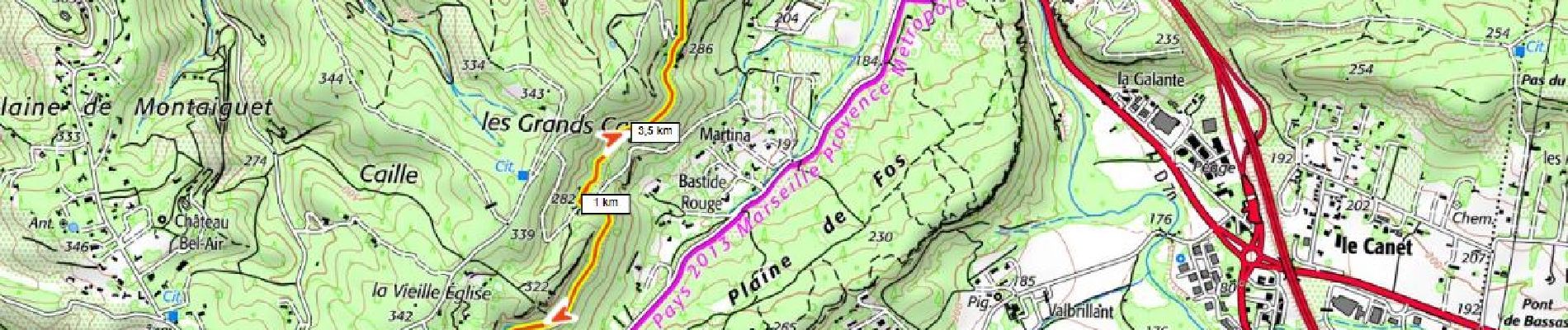
le canal de Meyreuil

ericberlin
User
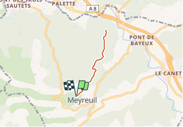

Length
4.6 km

Max alt
299 m

Uphill gradient
58 m
Km-Effort
5.4 km

Min alt
272 m

Downhill gradient
58 m
Boucle
Yes
Creation date :
2023-06-18 19:45:43.959
Updated on :
2023-06-18 20:02:52.749
1h13
Difficulty : Easy

FREE GPS app for hiking
 SityTrail
IGN / Geographical institutes
SityTrail Plus
The world is yours!
About
Trail Walking of 4.6 km to be discovered at Provence-Alpes-Côte d'Azur, Bouches-du-Rhône, Meyreuil. This trail is proposed by ericberlin.
Photos

Positioning
Country:
France
Region :
Provence-Alpes-Côte d'Azur
Department/Province :
Bouches-du-Rhône
Municipality :
Meyreuil
Location:
Unknown
Start:(Dec)
Start:(UTM)
701621 ; 4817990 (31T) N.
Comments