


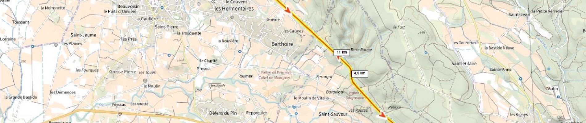
Canal de Pourrières

ericberlin
User
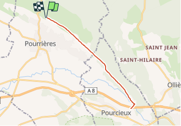

Length
14.6 km

Max alt
351 m

Uphill gradient
142 m
Km-Effort
16.5 km

Min alt
333 m

Downhill gradient
142 m
Boucle
Yes
Creation date :
2023-06-18 21:17:05.309
Updated on :
2023-06-18 21:20:33.102
1h08
Difficulty : Easy

FREE GPS app for hiking
 SityTrail
IGN / Geographical institutes
SityTrail Plus
The world is yours!
About
Trail Mountain bike of 14.6 km to be discovered at Provence-Alpes-Côte d'Azur, Var, Pourrières. This trail is proposed by ericberlin.
Photos

Positioning
Country:
France
Region :
Provence-Alpes-Côte d'Azur
Department/Province :
Var
Municipality :
Pourrières
Location:
Unknown
Start:(Dec)
Start:(UTM)
721334 ; 4821824 (31T) N.
Comments