


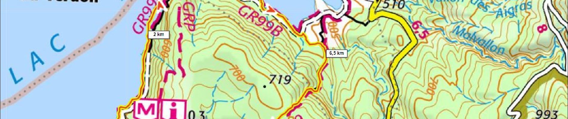
Au bord de Ste Croix 280m+ depuis Bauduen

ericberlin
User
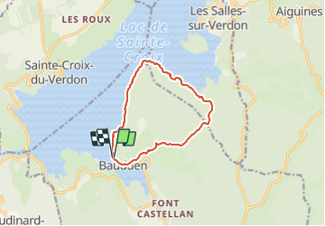

Length
10.9 km

Max alt
696 m

Uphill gradient
285 m
Km-Effort
14.7 km

Min alt
474 m

Downhill gradient
288 m
Boucle
Yes
Creation date :
2023-06-19 20:07:47.992
Updated on :
2023-06-19 20:10:56.638
3h20
Difficulty : Difficult

FREE GPS app for hiking
 SityTrail
IGN / Geographical institutes
SityTrail Plus
The world is yours!
About
Trail Walking of 10.9 km to be discovered at Provence-Alpes-Côte d'Azur, Var, Bauduen. This trail is proposed by ericberlin.
Description
Amener eau, chapeau, maillot.
Photos

Positioning
Country:
France
Region :
Provence-Alpes-Côte d'Azur
Department/Province :
Var
Municipality :
Bauduen
Location:
Unknown
Start:(Dec)
Start:(UTM)
272326 ; 4846371 (32T) N.
Comments